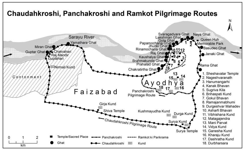
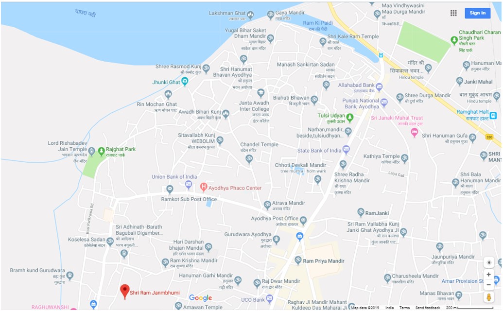
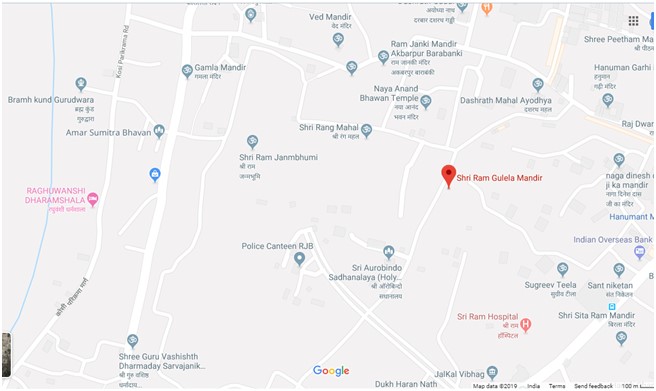
Skanda Purana describes many teertha locations of Ayodhya in a vivid manner. It gives the exact local directions leading to Shree Rama’s janmabhoomi (birth spot). This is an accurate match with the equivalent present-day locations in Ayodhya.

| Ancient Ayodhya’s teertha description from Skanda Purana 2.8.1-10 | Present-day Ayodhya’s location in the corresponding direction, an exact match |
| Chakra teertha and Vishnuhari | Chakra teerth ghat |
| East of Chakra teertha is Brahma kunda | Brahma-kund Gurudwara |
| Northeast of Brahma kunda is Rnmochana | Rinmochana ghat |
| Near Rnmochana is Papamochana ghat | Papamochana ghat nearby |
| East of Papamochana is Sahasradhara or Lakshmana teertha | Lakshman ghat |
| Lakshmana merges with Adi- Shesha, the divine serpent | Sheshavatara temple |
| Ascension of God Rama from Swarga dwara | Swargdwar ghat |
| Near Swarga dwara is Chandrahari, to its southeast is Dharmahari, to its south is swarna-khani and to its south is confluence of Sarayu and Tilodaki | Chandrahari is near Swargdwar, and there is a confluence of Sarayu River and a small stream on Google maps |
| West of this confluence is Seeta kunda | Seeta-kund, east of Vidya-kund and Mani Parvat |
| West of Vishnu-Hari is Chakra-Hari | Chakra-Hari on yatra map |
| Near Chakra-Hari is Gupta-Hari. 3 yojana west of Gupta-Hari is confluence of Sarayu and Gharghara | Guptar ghat, and confluence of Rivers Sharda and Ghaggar |
| Northwest of Seeta kunda is Kshirodaka where Dasharatha did putreshti yagnya | Dashrath mahal |
| Southwest of Kshirodaka is Brihaspati kunda, then south is Rukmini kunda, then Northwest is Dhana-yaksha, treasurer of King Harishachandra, then north is Vasishtha kunda | Brihaspati kund on yatra map; Guru Vashishtha Dharamshala on Google map |
| West of Vasishtha kunda is Sagar kunda, then southwest is Yogini kunda, then east is Urvashi kunda, then south is Ghosarka kunda, then west is Rati kunda, then west is Kusumayuddha kunda | Kushmayudha kund on yatra map |
| West of Kusumayuddha kunda is Mantreshwar Shivalinga temple | God Shiva temple |
| North of Mantreshwar temple are Goddesses Sitladevi, Bandi and Chudaki | There seems to be 3 mosques here |
| East of Goddess Chudaki temple is Maharatna teertha | Mani Parvat, meaning mountain of emeralds |
| Southwest of Maharatna teertha are 2 lakes Durbhara and Mahabhara | Durbharsar on yatra map |
| Northeast of Durbhara is Mahavidya kunda | Vidya kund on yatra map |
| Dughdeshwar Mahadeva temple | Durgeshwar Mahadev temple |
| On the eastern side is Taponidhi teertha, then to its west is Hanumat kunda, then further west is Vibhishana saras (pond) | Hanumat Garhi temple; Vibhishan kund |
| Many teertha near River Tamasa including Bharata kunda at Nandigrama | Bharat-kund near Nandigram |
| North of these places is Veera Gaja (elephant) teertha | Mata-gajendra |
| South of Veera teertha is Lanka’s Surasa Rakshasa fort who came to defend Ayodhya; to the west of Surasa is Pindraka, then west is Vighneshwar | Sugreeva tila (fort) |
| Northeast of Vighneshwar, north of Vasishtha kunda, and west of Lomasha ashrama, is Shree Rama janmabhoomi. Reachingthis pious place one can achieve moksha (salvation). | To the north of Vasishtha Dharmashala, and west of Ram Gulela temple (Lomasha Muni ashram) is Shree Rama janma-bhoomi |
 The literary source describes Shree Rama’s palace walls enclosing most of the tirtha like Dasharatha mahal, Sita kund, Brahma kund, Vasishtha kund, Brihaspati kund, Hanumat kund, Vibhishan kund, Lomasha Rishi tirtha, Dughdeshwar Mahadeva temple and swarna-khani. The exact location of Shree Rama janmabhoomi described by Skanda Purana very accurately matches with the archaeological evidence found by ASI at the site in Ayodhya.
 The Hon’ble Supreme Court of India passed an order for construction of a temple at the exact location of Shree Rama janmabhoomi. The judgment referred to Skanda Purana 60 times. The order was also based on Archaeological Survey of India’s survey reports and ground penetrating radar reports. The SC order can be downloaded here.
